[ad_1]
The latest “pineapple express” arriving Wednesday afternoon could drop anywhere from 4 to 8 inches of rain in just 48 hours – and Petaluma police are warning residents to prepare by setting out sandbags, clearing gutters and checking in with neighbors, among other suggestions.
“Several atmospheric river events will bring heavy rains and strong winds to the entire North Bay region through the end of this week,” police stated in a Tuesday afternoon alert. The already-saturated ground, they said, could lead to flash flooding, downed trees, power outages and “rapid ponding of water.“
To minimize storm damage, city and county crews from public works, fire and police agencies have spent Tuesday prepping, and will be ready Wednesday to “respond to road closures, blocked storm drains and storm related debris falling on the streets and sidewalks,“ Petaluma police said.
Among the tips offered by local authorities, residents are advised to stock up on supplies such as water and flashlights, clear nearby gutters and storm drains, and set out sandbags as needed. For those in more flood-prone areas, police recommend turning off power and gas beforehand (see sidebar), and to “Check on your neighbors, friends and family – especially those who may be vulnerable in case of emergency.”
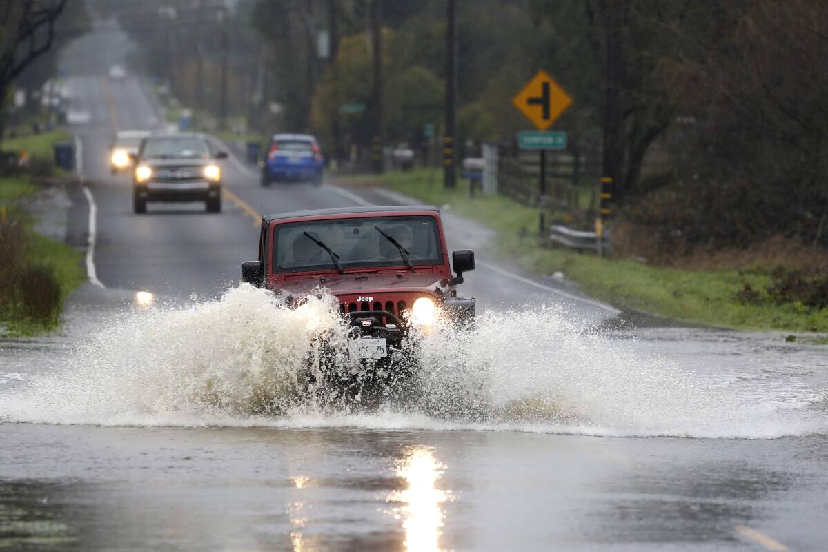
Police also advised residents to “avoid unnecessary travel.” If travel is necessary, use extreme caution by going slowly and allowing extra room for other vehicles on the roadway. If street lights are out, treat intersections as 4-way stops – and always watch for downed power lines, which should be reported by calling 911.
“Most flooding deaths during a storm occur in a vehicle,“ police said. ”Do not attempt to drive through flooded areas,“ which can look less deep than they are.
Besides heavy rain, this latest atmospheric river is forecast to bring sustained 20-30 mph winds out of the south, with gusts up to 50 mph and 60 mph above 1,000 feet. At the coast, gusts could hit 70 mph, according to the National Weather Service.
A flood watch has been issued for much of the state, and a high wind warning is set to take effect at 4 a.m. Wednesday and last until 10 a.m. Thursday morning for most of the Bay Area.
Sonoma County and surrounding counties will be at their highest risk this week for flooding, mudslides and downed trees and power lines, as rain rates could reach 1 inch per hour.
The heavy rain is expected to end by Thursday afternoon. Then, after a 24-hour break, a weaker but still strong storm is expected to begin Friday night.
Press Democrat reporter Madison Smalstig contributed to this report.
[ad_2]
Source link